
The United States Department of State has admitted responsibility for a glaring geographical error after displaying a map of Africa with multiple countries incorrectly labeled during a major international health conference, triggering criticism from diplomats, health experts, and Africa watchers.
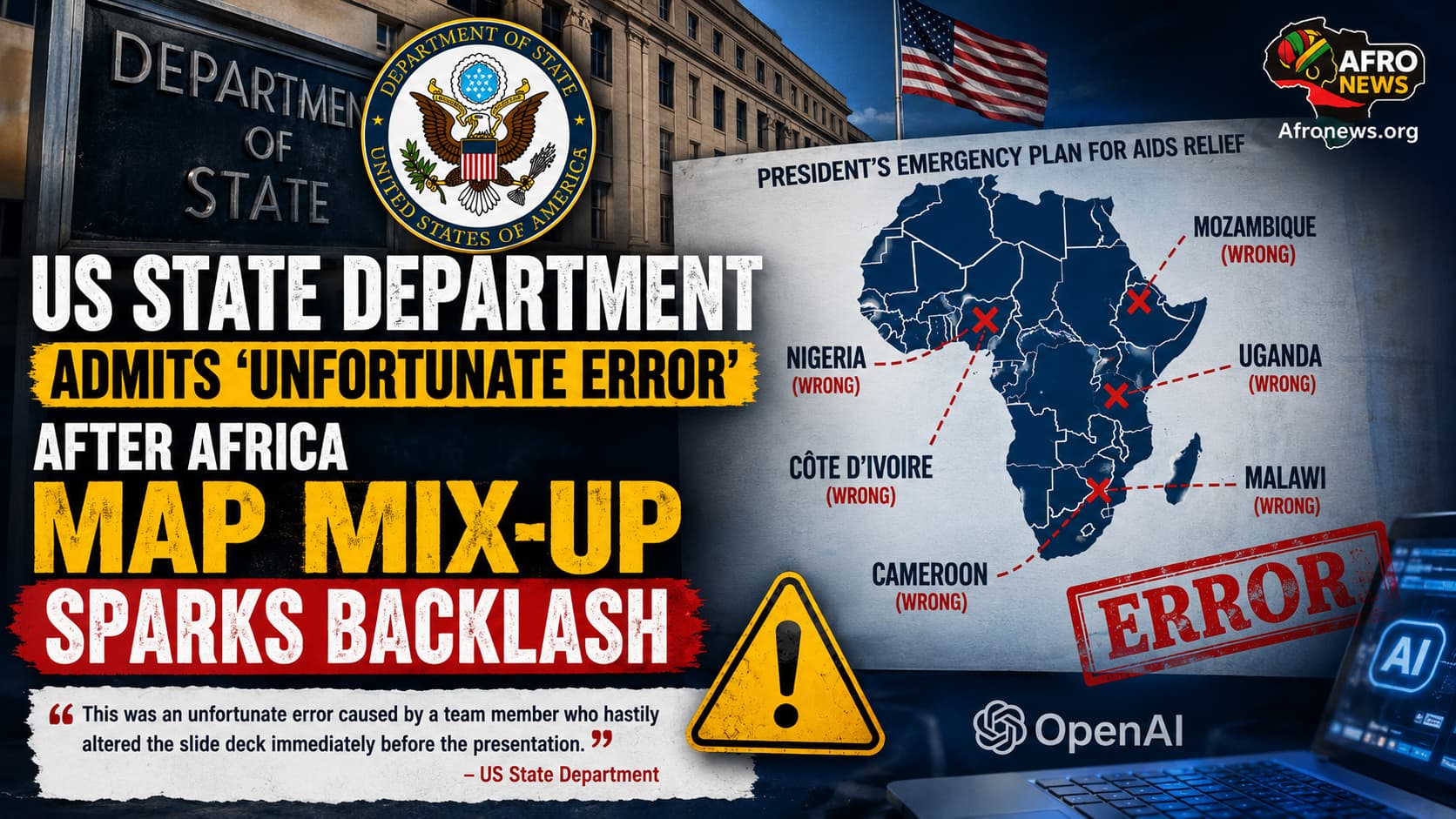
The erroneous map was presented during a session at the AIDS 2026 Conference in Rio de Janeiro, Brazil, where US officials highlighted six African countries central to HIV/AIDS programmes: Nigeria, Mozambique, Uganda, Côte d’Ivoire, Malawi, and Cameroon.
However, every country on the map was misplaced.
Related Post




Among the most notable mistakes, Nigeria, which sits on the Gulf of Guinea, was incorrectly shown as a landlocked nation. Mozambique, located in southeastern Africa, appeared in the Horn of Africa, while Côte d’Ivoire was shifted to the opposite side of the continent. The remaining countries were also incorrectly identified, raising concerns about the accuracy and quality control of official US government presentations.
The blunder quickly gained attention after a photograph of the presentation slide was shared by AIDS policy expert Emily Bass on her Substack page. A subsequent Reuters analysis reported that the image contained an artificial intelligence watermark indicating it had been created using OpenAI tools, prompting fresh debate over the use of AI-generated content in official government communications.
In a statement on Thursday, a State Department spokesperson described the incident as “an unfortunate error,” explaining that the mistake occurred after a team member made last-minute edits to the presentation shortly before it was delivered.
“This was an unfortunate error caused by a team member who hastily altered the slide deck immediately before the presentation at the AIDS 2026 Conference,” the spokesperson said.
The department also issued an apology, saying it accepted full responsibility for the mistake.
“We take full responsibility for the confusion and misrepresentation it caused for attendees, including our African partners.”
The incident comes at a sensitive time for US diplomatic engagement with Africa. Since President Donald Trump’s return to office, the State Department has undergone sweeping restructuring, while major reductions in US global health funding have affected numerous international aid programmes, including several across Africa.
Former State Department and National Security Council official on Africa, Cameron Hudson, argued that the embarrassing mistake reflects deeper institutional challenges following widespread staffing cuts.
According to Hudson, reducing experienced personnel and placing greater responsibility on junior staff has weakened oversight and increased the likelihood of such errors.
“There isn’t just a cost savings when eviscerating staff and expertise. There’s a real cost in reputation and effectiveness,” he wrote on X.
He warned that if similar lapses occur in more sensitive areas, such as nuclear negotiations or international diplomacy, the consequences could extend far beyond an embarrassing presentation.
The incident has reignited discussions about the importance of cultural competence, geographic literacy, and rigorous fact-checking in diplomatic communications, particularly when engaging with African nations that have long sought more respectful and informed international partnerships.
References
- Reuters – US government map of Africa mislabels every country at global conference
Reuters report - US Department of State – Official statement acknowledging the presentation error (quoted in Reuters coverage).
U.S. Department of State - Emily Bass – To End a Plague… Again (Substack) – First published photographs and analysis of the erroneous Africa map shown at the AIDS 2026 Conference.
Emily Bass Substack - AIDS 2026 Conference – Official conference information and programme.
AIDS 2026 Conference